
The Teaneck Plan
In 1933, the Office of the Township Planning Board of Teaneck made a master plan for the future development of Teaneck, including the plan for the street system, traffic regulation, public buildings, the sewer system, etc.

Master Plan Township of Teaneck (map)
Plan for the Complete Development of the Civic Center, Township of Teaneck (map)
| TEANECK TOWNSHIP COUNCIL |
|---|
| KARL D. VAN WAGNER, Mayor |
| SAMUEL S. PAQUIN, Councilman |
| MILTON G. VOTEE, Councilman |
| LOUIS G. MORTEN, Councilman |
| FREDERICK T. WARNER, Councilman |
| PLANNING BOARD OF TEANECK, NEW JERSEY |
|---|
| Mr. Milton, G. Votee, Chairman |
| Mr. Freddric Andreas, Secretary |
| Mrs. Fairchild N. Ferry |
| Mr. Paul Volcker |
| Miss Mattie S. Scott |
| Mr. Arthur Raymond |
| Mr. Fredrick T. Warner |
| Mr. A. A. Jensen |
| Mr. George B. Hitchcock |
| Technical Advisory Corporation |
| Consulting Engineers |
To The Honorable Township Council of Teaneck, N. J.
Gentlemen: —
On September 1, 1931, your honorable body adopted an ordinance (No. 625) pursuant to the provision of Chapter 235 of the Laws of New Jersey 1930, establishing a Township Planning Board of nine members empowered, among other things, to prepare an official map and a master plan for the future development of the community, to assume control over the subdivision and platting of land within the Township, and to report on such matters as you might refer to the Planning Board.
The personnel of the Planning Board was appointed October 20, 1931, but it was not until March 15 of the following year that the Board was placed in position to begin its studies on a comprehensive basis, at which time the services of the Technical Advisory Corporation of New York were engaged, with your authority, as the engineers and planning consultants to the Board. Acting for the Board, that organization has made exhaustive surveys and studies of Teaneck and of all the factors and conditions considered pertinent to community planning, besides having prepared many maps, drawings, records, and compilations for the consideration of the Board. Since that time the Board has had the constant advice and guidance of Mr. Campbell Scott, the president of the advisory organization.
Pursuant to your authority the Planning Board has adopted very carefully worked out rules and regulations governing land subdivision and platting and has passed on several subdivision plats. These rules in printed form are available to persons interested.
On the recommendation of this Board you have already adopted as the temporary Official Map of the Township a map prepared by the Board’s engineers from the tax maps as an interim expedient.
The Planning Board now has the pleasure of submitting to you herewith a revised Official Map, based upon a newly drawn base map, as revised to September 8, 1932, and approved by the Planning Board. It is respectfully recommended that this revised Official Map be formally adopted, after public hearing and through a Council ordinance, as the Official Map of Teaneck.
There is also presented herewith a Master Plan of Teaneck which has been formally adopted by the Planning Board as provided by statute. In the preparation of the Master Plan it has been the endeavor of the Board and its consultants to anticipate the probable principal needs of the Township during at least the next twenty years with respect to new and extended streets, parks, playgrounds, public building sites, bridges, etc. It is not the expectation of this Board that recommended improvements involving considerable expenditure of public funds shall be undertaken until the municipality is in position to finance them without placing an onerous burden of expense on the taxpayers. (See Chapters 4 and 5.)
There is appended hereto a detailed report on the studies, findings, and recommendations of the Planning Board which includes an explanation of the Official Map and of the Master Plan, together with a tentative program of execution and suggestions for its financing. It is the earnest desire of the Board that this entire report, constituting the Teaneck Plan, shall receive your careful study and consideration, for it is believed that the conscientious carrying out of the Teaneck Plan will result in the building up of a populous community of which the present and coming generations may be justifiably proud.
While it is desired and requested that the Official Map, as revised, be adopted by ordinance, it is not requested that you adopt the whole Master Plan by ordinance, since it has been formally adopted by the Planning Board as provided by the planning law. The reason for this is that the Board, while using the Master Plan as a guide in its future activities, may find it advisable to make certain revisions and additions from time to time. In order that the Board may be enabled to learn of the attitude of the Township Council respecting the Master Plan and its execution, however, it is suggested and hoped that the Council will adopt a suitable resolution indicating that the Master Plan will be followed at least as a guide in making such future public improvements as are embraced herein. It is also hoped that the various other recommendations embraced in the Teaneck Plan will be followed.
The meetings of the Planning Board have always been open to the public and many interested citizens have presented their views at various times. These have always been carefully considered.
The Planning Board has also caused to be printed in the various publications in circulation in the Township articles which would show in a general way what it proposes to do. It has held one public meeting at which its consultant was the principal speaker and to which not only the public but representative citizens on various advisory boards and civic societies were invited, as well as the Council itself. Everything possible has been done to inform the public as the Planning Board progressed with its program.
In order that the public spirited citizens of Teaneck may be fully acquainted with the Teaneck Plan and be able to support its aims, it is intended that this entire report, with reproductions of the various maps and plans, will be printed and distributed to those interested.
Respectfully submitted,
TOWNSHIP PLANNING BOARD OF TEANECK, NEW JERSEY.
M. G. VOTEE, Chairman.
FREDERIC ANDREAS, Secretary.
Municipal planning, like most projects in which esthetic values play a large part, is looked upon by the lay mind in general as something which would be “fine for the town” but from which there would be no tangible result in the near future, if ever. In the Township of Teaneck especially, with several fine residential sections, excellent streets and other improvements, and fine public buildings, it is not immediately evident to those who have not studied the problem why a plan should be made and followed over a period (in this case) of twenty years. There are, however, several important and pressing reasons why Teaneck should adopt a plan and begin to effectuate it at once.
No clear understanding of the economic principles involved can be possible unless the stupendous growth of the Township is realized and a clear picture obtained of the community as it exists today. Careful studies of area and population have therefore been conducted and the results of these surveys are presented herewith to form a background for what is to come.
Teaneck has an area of approximately 6 1/2 square miles, of which more than 90% is suitable for building purposes. Making suitable allowance for streets, parks, and other public open spaces, and allowing for the same general character of development in the future as has occurred during the last decade, it is estimated that there is room in Teaneck for at least eight times as many buildings as now exist.
While the increase in population of Bergen County during the last thirty years has been remarkable, that of Teaneck during the same period has been little less than phenomenal, as the following figures compiled from the Federal census will indicate:
| 1900 | 1910 | 1920 | 1930 | |
|---|---|---|---|---|
| Bergen County | 78,441 | 138,002 | 210,703 | 364,977 |
| Teaneck | 768 | 2,082 | 4,192 | 16,513 |
 From the above it will be seen that the population of the entire County in 1930 was 4.6 times its population in 1900, while in 1930 Teaneck had a population 21 times that of 1900. In both cases the greatest increase occurred in the last decade.
Studies have been made of the building operations which have been carried on between the 1930 census and July, 1932, which indicate that on the latter date the population of Teaneck was about 18,000.
During the thirty year period from 1900 to 1930 Teaneck grew at an average rate of 600 persons per year. Were only this rate of increase continued for the next twenty years the population would be then at least 30,000, while if the average rate of growth between 1920 and 1930 were maintained the population in 1952 would be about 42,000. The Regional Plan Association, which made careful studies of the population growth of the metropolitan district, predicts for Bergen County a population of about 1,000,000 by 1965, or about 547,000 by 1940. Figuring on this basis the population of the county would be about 750,000 in 1950. On the same basis of growth Teaneck should have a population of at least 40,000 in 1952.
The growth of Teaneck during the next twenty years is of course problematical, inasmuch as it will be governed by many factors and conditions, most important of which are: when general economic conditions will return to normalcy, and the extent to which land subdivision and home building on a large scale will be carried on by progressive developers in the future as in the past. Considering all conditions, limitations, and factors, however, it seems safe to assume that the population in 1952 will be not less than 40,000 and possibly more nearly 50,000.
In this connection it is interesting to note that the intersection of State Highway Route 4 and Queen Anne Road divides Teaneck into four nearly equal sections. Studies of the present and probable future minimum population indicate the following approximate distribution among these four sections:
| 1930 | 1952 | |
|---|---|---|
| Northeast | 4,400 | 11,500 |
| Northwest | 2,300 | 7,500 |
| Southeast | 5,800 | 10,000 |
| Southwest | 4,000 | 11,000 |
| Total | 16,500 | 40,000 |
With these facts and figures as a basis the Planning Board has arrived at three major premises which form, it is believed, a logical point of departure upon which to build a plan for the future, and it is upon these points that the Board, with its consultants, has formulated the Teaneck Plan. The findings are as follows:
1. That despite the effects of the existing economic condition Teaneck will continue to grow rapidly and that twenty years hence at least 40,000 persons will live within its area.
2. That everything possible should be done to preserve Teaneck’s many advantages and charms and to encourage its future development as a predominantly residential community of the best type.
3. That the community’s welfare can best be conserved and advanced by following, during the next twenty years at least, a comprehensive plan for supplying the Township’s expected needs in the way of major public works and various other improvements.
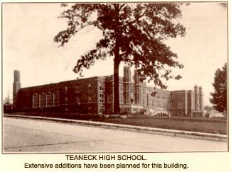
 A casual reading of the Plan as the Board now presents it will show the reader that all of its more important phases are founded upon these theses, while a careful study will reveal the fact that every detail, even the most minor, similarly follows the guidepost set up by the preliminary surveys and their conclusions. The Plan recommends the proper development of a system of thoroughfares, the acquisition and development of park sites, the erection of additional public buildings and the enlarging of existing structures, and various other types of development. All of these are being presented with an eye towards the greatest good for the greatest part of the population of the Teaneck of the future and the conservation for its citizens of the advantages which they now enjoy.
But before going further the Board feels that it should warn the reader against approaching the study of the Plan with a rigid mind. The Plan itself is not rigid; rather is it widely elastic, and for obvious reasons. In attempting to cover a span of twenty years it is possible to estimate and to arrive at approximated conclusions, but it is not possible to forecast in minute detail the happenings of even a year hence, much less those of a score of years. Changes may occur which would necessitate different courses for highways, different sites for buildings and parks, or different directions for sewer lines.
As a practical instance of what is meant, there is included in this report a tabulation of the property to be taken over by the Township for other than street purposes. These pieces of property are recommendations only and are subject to change if conditions warrant it. Even if the Plan is adopted as presented, the municipality is not bound to acquire all or any one of these sites for any purpose. They appear to be best suited for the specific purpose set forth at this time, but what the years may bring this Board is certainly not prepared to foretell.
The reader must study the Plan, therefore, with a mind which views the Township as a whole and in the light of future, as well as present, conditions. He must think of it as a program to be developed gradually and with a constant watchfulness to see that the best interests of Teaneck, esthetically, socially, and economically, are fostered and preserved. It is on this basis that the Planning Board offers the citizens of the community the Teaneck Plan.
Although each part of the Master Plan presented herewith is closely correlated with every other part and the basis for each proposed change is the same, the Board feels that it is impossible for the mind to, grasp a project of such magnitude in its entirety. For this reason the major phases of the Plan have been broken down into subdivisions and are presented in sequential order as individual units that they may be studied apart from their relation to the whole.
It has also been deemed advisable to include short descriptions of conditions as they now exist so that the reasons for the proposed changes or improvements may be more clearly understood. No attempt should be made to study the Plan or any of its parts without constant reference to the maps which are appended hereto, and which are a part of this report.
 If a municipality may be compared to a human being, then its streets must be compared with the human skeleton. The major thoroughfares are the backbone, the ribs, and the long arm and leg bones. The minor streets are the bones in the fingers, the toes, and other parts of the body. A town with an irregular, poorly laid out street system is as helpless as a person whose bones, once broken, have been mended in a misshapen, malformed fashion.
Teaneck’s street system was not laid out in accordance with any general plan, but rather through subdivision platting, and the result is an expression of the diverse ideas of many individual subdividers. Consequently the existing street pattern shows many variations in street directions, and widths, as well as innumerable dead-end streets, jogs, and missing connections. Lack of proper control of land subdivision in the past by the municipal government and the absence of proper regulations and maps for the guidance of developers are mainly responsible for these defects, which even a superficial study of the Existing Conditions Map will make apparent.
At the beginning of the current year the Township map showed about ninety-two miles of streets (not including the State Highway), of which about fifty per cent are improved. The remainder are either unimproved dirt roads or “paper” streets not open for vehicular traffic. Of the forty-six miles of improved streets all but about five miles have permanent pavements. The Existing Conditions Map shows the various classifications of streets, street and pavement widths, character of pavement, and those streets which are unimproved, not open, etc.
There are, however, certain good features of the existing pattern. Several of the more important thoroughfares are sixty feet wide and the great majority of the streets are fifty feet or more in width. It is also possible to create a number of additional major thoroughfares by extending existing streets or supplying missing links. In general, sidewalk and curb construction has closely followed street improvement, especially in the newer and better subdivisions, and the majority of these sidewalks are well constructed. There are still many gaps to be filled in, however, some of them extending for several blocks.
Another excellent feature is the small percentage of sidewalk and street encroachments. There are relatively few cases in which vending stands, gasoline pumps, displays, or street signs interfere with the use of the streets and sidewalks or offend the eye. Street tree planting has also followed the proper lines and Teaneck as a whole may feel proud of its trees. There are some stretches where trees are missing and others where the trees need attention, but these are not a majority.
The Plan provides for the entire street system in almost minute detail. In only a few cases are the minor streets not provided for, and in these cases the nature of the terrain is such as to permit wide variations in laying out streets when development begins. The Master Plan map, a part of this report, clearly delineates all of the suggested additions and changes in the street system, and for that reason only the treatment of the most important thoroughfares and proposed new routes will be described in detail in this report.
Teaneck Road. This is a County highway and is the longest through artery in the Township. It is at the present time, and probably always will be, the most important north-south thoroughfare.
Its width now varies greatly as to right-of-way, roadway, and paving. Steps have already been initiated to establish a new right-of-way width of eighty feet throughout. The Master Plan Map indicates the stretches along which the right-of-way must be widened. The County government should be urged to start the physical improvement of this important thoroughfare as soon as financial conditions will permit. The work should be planned on the basis that the ultimate paved roadway width shall be at least fifty-four feet; meanwhile a permanent pavement thirty-six feet wide should be provided.
 Queen Anne Road. The Master Plan Map shows the easy conversion of this street into a through thoroughfare extending from Bogota to Englewood by the addition of Irving Street and Tryon Avenue. Much of this route already has a street width of sixty feet and a roadway width of thirty-six feet. The Plan shows those sections of the three streets which should be widened to sixty feet, all of which can readily be done without touching any buildings. The short stretch between Court Street and Market Street cannot be widened except at the expense of existing buildings, but a roadway width of thirty-six feet can be provided from Grove Street north to Tryon Avenue and thence to the Englewood line.
From a point about fifty feet north of Grove Street, south to Highwood Street, the street width is fifty feet and the roadway width is thirty-two feet. The street width should be increased to sixty feet and the roadway width to thirty-six feet. This can be done without encroaching on any existing buildings.
In the business district lying between Highwood Street and Fort Lee Road, where there already is a serious congestion of traffic, the street width is fifty feet and the roadway width is thirty-two feet. The desirable widening of this stretch can be accomplished only at considerable expense, as it would involve moving back, or cutting off the fronts of, buildings on the west side of the street to procure a street width of sixty feet and a roadway width of thirty-six feet. Although this widening is not shown on the Master Plan, it is recommended that the Township Council give the fullest consideration to this important matter.
It is important, also, that new street lines should be established along this route without delay and before any more buildings are erected on the present street frontages.
Palisade Avenue. Although this street is mapped from the Bogota line north to West Englewood Avenue, it does not actually exist north of Grayson Place as an improved street. An additional needed north-south thoroughfare can be established by completing this important avenue all the way through and adding as logical extensions Dame and Sackville streets. By widening the short stretch from Cedar Lane to Cherry Lane this route will have a street width of not less than sixty feet as far north as State Street and thence a width of fifty feet, with a roadway width of thirty-six feet throughout. This improvement will relieve Queen Anne Road, now a residential thoroughfare, where heavy traffic is undesirable.
Cedar Lane. This is another County road and is, in part, the most heavily traveled of the crosstown thoroughfares excepting State Highway Route No. 4. Unfortunately it has not been improved east of Teaneck Road.
The present right-of-way and roadway widths and the width of the permanent pavement vary greatly. Between the Hackensack River and Teaneck Road, however, there is a minimum existing right-of-way of sixty feet and Broadway width of forty feet. It is understood that the County authorities have considered the improvement of Cedar Lane east of Teaneck Road, crossing Overpeck Creek and eventually connecting with Sheffield and Grand avenues in Englewood. This is a most desirable improvement and one which the Township authorities should urge upon the County government. This extension should have a width of not less than sixty feet and a paved roadway width of not less than forty feet.
Vandelinda Avenue. The Master Plan Map shows that by supplying certain missing links and another bridge over the West Shore Railroad, a new crosstown route could be supplied by connecting Kipp Street, Vandelinda Avenue, and Letter Avenue. This route could readily extend from the Hackensack River to Overpeck Creek and eventually be carried over those two streams by means of bridges into Hackensack and Leonia respectively. This route would have a fifty-foot right-of-way and a thirty-six foot roadway. The connection with Hackensack would be over an easy route to Passaic Street. The topographic conditions are such that bridges over the railroad and the streams could readily be constructed at such heights as not to impede rail or water transportation.
Even though this route connected only with River Road instead of crossing the Hackensack River, and even though it extended no further east than the proposed Lafayette Avenue extension, it would be most desirable in connecting the southeast and southwest corners of the town and relieving Cedar Lane. If the connection is carried across the river into Hackensack, the bridges should be built by the County and the road taken over by the County.
A New North-End Route. Another extremely desirable through thoroughfare could and should be provided by connecting Tryon Avenue, Winthrop Road, Edgewood Road, and Riverview Avenue. The widening of Tryon Avenue has already been discussed, but Riverview Avenue should be widened to sixty feet, with a thirty-six foot roadway; then in no place would the route be less than sixty feet wide with a thirty-six foot roadway.
The establishment of this route would require the building of a bridge over the West Shore Railroad and Palisade Avenue. In this case also the topography is such that this bridge could be constructed very easily.
Sagamore Avenue. The Master Plan discloses how few missing connections along the lines of Grayson Place and Sagamore Avenue are necessary to establish another crosstown thoroughfare extending from River Road to Glenwood Avenue and the ramp of the State Highway. The present streets composing this route are all fifty feet or more in width, with roadways of not less than thirty feet. The bridge now over the railroad is narrow, weak, and antiquated; it makes a crooked and dangerous connection with Sagamore Avenue. It should be replaced by a new bridge having a roadway width of thirty-six feet and two six-foot walks, because of its extensive use by high school students.
Lafayette Avenue Extension. The Master Plan shows also the best route between the Englewood line and Fort Lee Road for the southerly extension of Lafayette Avenue as proposed by outside groups. The extension south of Fort Lee Road is not shown, for its proper alignment would depend upon several undetermined factors. If this extension is carried through Teaneck, it should be as a regional or County project, for the improvement and development of the Overpeck Creek marsh area should be for park purposes and this route should be a link in the parkway system.
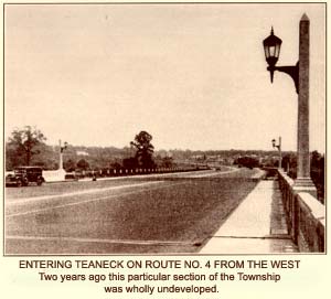
Under ordinary conditions Teaneck streets are not overcrowded with motor vehicles. Only during the period of maximum traffic flow on weekends and holidays is there any serious congestion, and even that has been greatly relieved by the opening of State Highway Route No. 4. Fort Lee Road and Teaneck Road are the two routes which are particularly in need of early relief on this score.
 Such over-burden of vehicular traffic as Teaneck now has to contend with results almost entirely from out-of-town vehicles. During the rush hours of commuters and local shoppers, however, there is frequently congestion of cars at the two railroad stations and in the business districts centering about Queen Anne Road and West Englewood Avenue, Teaneck Road and Forest Avenue, Cedar Lane and Palisade Avenue, and at the south end of Queen Anne Road. These latter congestions are generally the result of motorists exceeding the parking time limits at these points. This condition could be much improved by reducing the allowable parking time and enforcing this regulation more strictly.
Considering the small number of policemen assigned to traffic duty and that there are but eight automatic traffic signals, installed at the more important thoroughfare intersections, vehicular traffic flow throughout the town is unusually well handled. As the enlarged through thoroughfare system is completed, however, additional automatic signals will be necessary.
Most of the automobile parking about the two railroad stations is in the public streets, and while generally fairly adequate for present conditions, except during the heaviest rush hours, there is need for anticipating future needs and providing for them. The Master Plan shows how about one and a half acres of additional parking space may readily be provided at these places.
Few comparable suburban towns are so well supplied with transportation facilities as Teaneck. The West Shore Railroad with its two stations supplies good and presently adequate transportation to a great number of New York businessmen who have made their homes in Teaneck; while the Public Service electric line running between the Fort Lee ferry and Paterson supplies from ten- to twenty-minute service especially convenient to residents of the south end of town.
At least seven bus lines pass through Teaneck, giving frequent and comfortable service not only to all the abutting communities but to New York. The present bus routes generally follow the existing through thoroughfares and in general the best available routes. As the enlarged thoroughfare system, as shown on the Official Map, is completed and improved, however, the Planning Board will from time to time make recommendations concerning revised and additional bus routes.
 If the street system of a community may be likened to its bone structure, then park and playground areas are certainly its flesh, imparting beauty and sustaining the life which exists within. And it is in this department that Teaneck is woefully lacking. With a generally accepted standard of one acre of park area to each one hundred inhabitants, Teaneck now has one acre to about four thousand population. The only thing resembling a park which the Township owns is the planted area and triangle at the intersection of State Street and Windsor Road, containing an area of about four acres. The only municipal playground, other than school yards, is the small corner on the Municipal Building property which has been set aside and partially equipped for children’s play.
It is a striking indication of the need for playgrounds that the small space at the Town Hall is constantly crowded during the summer, and that all of its limited facilities are so evidently enjoyed by the children using them. Even this area is not ideally located, since there is no extensive residential development in the near vicinity.
Thus it may be seen that it is most desirable, in view of the expected population increase, to provide many such additional areas, and when all of those shown on the Official Map are completed there will be a total park and playground area of about seventy-four acres–about enough for 7,200 persons. Additional space should come through donations of additional areas by subdividers and County and regional parks within the Township.
The Master Plan shows eleven parks (nine containing playgrounds), four children’s playgrounds, two long park strips, and nine small plots in the shape of circles, triangles, or planting strips. All of these are to be acquired by the Township and developed and maintained for public use as recreational areas. These parcels (numbered S-1 to S-24C on the plan) have an area of approximately 75.20 acres. and at present carry an assessed valuation of approximately $245,285. The selected sites are at present unoccupied and are scattered throughout the Township in accordance with expected growth and future needs. Practically all of the park sites are well wooded.
 The Plan contemplates that the central park area (S-6), lying between Palisade Avenue and Queen Anne Road and containing about 16.6 acres, shall be developed as a combined athletic field, park, and playground. It will have a large field for baseball and football, tennis courts, and areas for other games and sports; picnic grounds; the usual children’s playground equipment; and a shallow pond for wading in summer and skating in winter. This site is not at all desirable for residential development, but it could readily be converted into a most attractive recreational center. Considerable drainage and filling will be required in certain parts, while other parts could easily be developed and placed in use at once. The work of drainage and filling could be spread over several years, during which period the many fine trees on the site should be carefully tended.
The two narrow strips of land lying between Palisade Avenue and the West Shore Railroad and between Windsor Road and the railroad, both in immediate proximity to the previously mentioned central park area, are also unsuited to residential development, as they are too near to the railroad. These strips (S-7 and S-9) have an area of approximately 13.1 acres. The Master Plan contemplates that these strips, in addition to being laid out as local parks and planted with shrubbery and flowers, shall be provided in part with playgrounds for small children, with tennis courts (and perhaps bowling greens), and various other facilities for games and recreation.
 The Township should also acquire the remaining area left within the block now occupied by the municipal building for additional space for public buildings as indicated on the map of the municipal grounds. This site (S-16) has an area of approximately .84 acre and is the logical extension of the municipal property. This lot also contains a great many fine trees, which should not be disturbed.
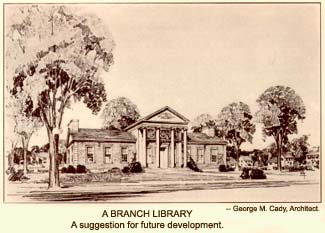
One of the most attractive of the park areas should be that lying immediately west of the Strand on the slope near the westerly end of Forest Avenue (S-23). This area contains about 3.2 acres and is ideally located with an attractive view toward the west and the mountains. It is not intended that this park shall be used as a playground, but that it shall contain a branch public library which is badly needed in the west side of town. (See section on Public Buildings.)
The Hackensack River offers little temptation at the present time for bathers and since there are no bathing places within Teaneck’s area and no convenient brook to dam and create a swimming pool, the only feasible way to supply the need is through the construction of a municipal pool, preferably in a central location as shown on the Master Plan. This pool, equipped with appropriate bath houses, could be made self-supporting through the charging of nominal fees.
An ideal location for this facility is that shown on the Master Plan lying between Colonial Court and Ferndale Avenue, east of Palisade Avenue. This site is ample in area to accommodate a pool as large as 90×200 feet and two adequate bath houses, with room left for the parking of several scores of automobiles. This site immediately adjoins the proposed central park and athletic field to the north and has the further advantage of being located near the geographical center of town. It is designated as S-17 on the Master Plan and contains seven acres.
It is not inconceivable that the swimming pool could be used in the winter as a skating rink.
The actual laying out of the parks and playgrounds in harmony with the topography and surroundings, and in accordance with the needs of the neighborhood and the purposes for which each is intended, should be done by a landscape architect employed by the Township. As many as possible of the existing trees should be preserved and safeguarded during this work and each combined park and playground should be attractively landscaped and planted with flowers and shrubs. The various small triangles, circles, corners, and narrow strips embraced in the park system should be in the form of grass plots with flowers.
Four small planting strips on the north side of the State Highway between Arlington and Madison avenues are remnants of lots left from the highway takings which are not suitable for building purposes. These plots are all at the level of the highway and if suitably planted with shrubbery and flowers would give travelers from the east a most favorable first impression of Teaneck.
 Each playground, and each park having an area of one acre or more, should be provided with public comfort facilities, and in each playground there should be a wading pool and spray as well as the usual play equipment.
Although not shown on the Master Plan, there are certain other areas which may become available for park purposes within the next twenty years. It appears almost certain that some time within that period the several municipalities along the Hackensack River and Overpeck Creek must join (perhaps with County aid) in the construction of a trunk sewer system comparable to that built by the Passaic Valley Sewer Commission. When this occurs it will be possible to abandon the existing sewer disposal plants and convert these areas into parks. Teaneck now has four such plants, two on the east side and two on the west side, having a total area of about 27.34 acres.
The Township may also count upon various County, State, and Federal developments to increase its park areas in future years. One instance of this is that property lying along both sides of the State Highway at Belle Avenue as indicated on the Master Plan. This tract contains about 2.3 acres and is now in the possession of the State of New Jersey, having been left over from the highway improvement. It is most desirable that the Township officials shall endeavor to procure from the State a gift of this property with the understanding that it will be developed and maintained for park purposes by the Township.
The Master Plan indicates also the approximate maximum areas which would probably be taken over for park purposes in the future were County or regional park systems established and developed along the Teaneck sides of the Hackensack River and Overpeck Creek.
Steps have already been taken by the Federal government for the improvement of the Hackensack River and various State, County, or regional commissions or organizations have initiated steps toward the improvement of the Overpeck Creek marsh area and the development of parks or parkways along both streams. Although such steps are at present in a rather nebulous state, it is reasonably certain that within the next decade these improvement projects will assume definite shape. Teaneck alone cannot be expected to establish park areas along the two streams, but the Township government should certainly co-operate fully in any State, regional, or County movement toward such an improvement. The benefits to the community would be great.
The need for additional facilities to house the various governmental functions of the Township is already evident and additions to the existing structures will be practically obligatory within a few more years. Fortunately, the Town Hall and its setting are something which the Township may well feel pride in, and the architectural features should remain unchanged. It will be a simple matter to add flanking wings to the present Town Hall in harmony with the present architecture, providing needed space for departmental suites, enlargement of the Council Chamber, and a municipal court room.
 The Police Department should be removed from the present building and located in a separate building at the north end of the municipal grounds, on plat S-16. The Plan provides also for three precinct stations, one in the park on site S-22, another in the park on site S-20, and the third in the present volunteer firehouse on Morningside Terrace, adjacent to park site S-14. The department is badly hampered even now by having to carry on its activities from one station at the Town Hall, and one precinct station, preferably on the west side, should be established as soon as possible.
The nucleus of a paid fire department has already been established in its headquarters on Teaneck Road, but this building is unsuitable and inadequate and should soon be abandoned. This property could be sold at a profit for business purposes, as it lies in a business zone. A new central fire station should be located adjoining the Town Hall and fronting on Cedar Lane, balancing the Library in its present location and thus creating a symmetrical group of buildings. This central location will afford better protection to all portions of the Township.
A great part of the Township’s fire protection is dependent at the present time on three poorly distributed volunteer fire stations. The rapidly developing northwest quarter of the municipality is unsupplied with apparatus of any kind. The removal of fire headquarters to the new location will make it possible for this apparatus to serve the entire east side of town in ordinary circumstances, but additional protection is vitally necessary to the west.
For this reason the Plan proposes the erection of two sub-stations on the west side. One of these will be on site S-25, containing about .46 acre, and the other will be located on site S-26, containing about .28 acre. The latter site provides also for a fourth police precinct station in addition to the three mentioned above.
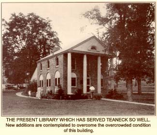
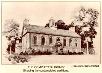
 The present Library building, adjacent to the Town Hall, is already inadequate for its purposes, although it has been open for less than five years. About twenty-five per cent of the population of Teaneck are active patrons of the Library, although the area immediately around this location is sparsely populated and the great majority of those using the Library live more than a mile away. The building is also badly congested with the large stock of books despite attempts to relieve this congestion by maintaining book collections in all of the public schools.
There has been some suggestion that the present Library be used for some other municipal purpose and a new and larger building constructed nearby. This is believed to be a mistake, as study discloses that additions can be made to this building making it entirely adequate for the purpose intended.
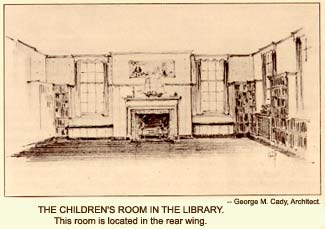
As a means of providing additional library facilities, particularly for the residents of the west side of town, the Plan contemplates the ultimate construction of a branch library in Strand Park. (See section of this chapter on Parks, etc.)
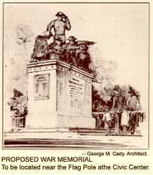
A study of the municipal grounds discloses that sufficient space exists for the future erection of a community building containing a small auditorium and separate rooms for the use of patriotic and civic organizations. It is suggested that a desirable site for a war memorial might be found on the axis of the present Town Hall, close to the street, where there will be an unobstructed view from Teaneck Road and Cedar Lane.
If Teaneck is not already entitled to a new government-owned main post office of sufficient size to take care of the probable future needs of the Township, it surely will be in the near future. The two rented buildings now in use are scarcely adequate to take care of the present needs of the community and they are most unattractive from an architectural standpoint.
The government’s requirements concerning the location of post office buildings are exacting and definite, however, and there are few vacant sites left in Teaneck which will exactly meet these requirements. The Board feels, therefore, that as soon as conditions are more propitious the Township Council and strong local organizations should forcefully make known to the federal government Teaneck’s desires in this direction. (It is understood that some steps have already been taken.)
The logical location for a main post office would be in the immediate vicinity of the intersection of Palisade Avenue and Cedar Lane. This section appears destined to become the principal business center of the town, a tendency in that direction being already evident. Another factor is that there are several lots now vacant which, it is believed, would meet with all of the requirements of the Post Office Department.
Should the government decide to build its own branch post office in the West Englewood district, an excellent location would be at or about the intersection of Palisade Avenue and State Street. (See Chapter 3.)
Teaneck is fortunate in having an excellent water supply, even though it is not owned by the Township. Almost the entire supply comes from the Hackensack Water Company and the service rendered by this company is satisfactory. A small portion of the lower end of the Township is supplied by the Bogota Water Company and the pressure in this system is inadequate at times. This latter system should be improved.
The recent completion of a large new water main in Teaneck Road and Cedar Lane, together with other fairly recent constructions, supplies all present needs, however, and assures the Township of an adequate supply of potable water for many years to come.
Not only is the water supply available in all improved and unimproved streets, but the gas supply is likewise up-to-date. All of the improved streets are likewise exceptionally well lighted by means of incandescent electric lamps, and telephone service is available throughout the entire Township. (See Chapter 3.)
Teaneck has about ninety-five miles of sanitary sewers which dispose of their effluent into the Hackensack River and Overpeck Creek through four disposal plants, aided by two pump stations and one re-lift station, all of which are well operated. Until a regional or County trunk sewer system is provided Teaneck must continue to operate these disposal plants. (See section of this chapter on Parks, etc.)
The laying of sanitary sewers has followed closely the actual developments in the different parts of town and in many cases has very properly preceded development, so that at present all built-up areas are served by sanitary sewers. Storm sewer development has closely paralleled that of the sanitary sewers, but there are still a number of more or less built-up areas which are without storm sewers.
A special map has been prepared and presented to the Township Engineer which shows all the existing storm and sanitary sewers and the various drainage areas. It is expected that this map will be kept up-to-date by adding new construction as it is completed.
DISPOSAL OF GARBAGE AND REFUSE
Teaneck cannot afford to continue much longer its present antiquated and unsanitary methods of disposing of its garbage and combustible rubbish. Garbage, ashes, and other wastes are now collected and disposed of, in the major part, by nearly a score of different licensed operators through private contracts with the householders. Between sixty and seventy per cent of the householders are thus served, the remainder disposing of their own wastes by various means. The garbage collected by the contractors is presumed to be taken to pig farms and the remaining waste is dumped within the Township and in many cases set afire. This method is sometimes of a nuisance character.
All of these wastes should be disposed of by incineration, now generally recognized as the most sanitary and efficient method of disposal. The Master Plan shows the location for an incinerator plant between Glenwood Avenue and Overpeck Creek. This is considered the best location available. (See Chapter 3.)
Although it is obvious that most of the plan, particularly those parts requiring the expenditure of large sums of money, cannot be accomplished at once, there are several steps which the municipal government can take with little or no expense to the taxpayers. It is the belief of the Board that the adoption of and adherence to the Official Map and the foregoing Master Plan will contribute largely towards the attainment of the desired results in the improvement and up-building of the Township, but there are certain additional steps which will safeguard the future development of the Plan in general.
 The Board therefore recommends that the municipal government proceed at once with the following matters:
1. The zoning ordinance as existing or amended should be strictly adhered to.
2. The zoning ordinance should be amended to change from Industrial classification to Residence B classification those areas lying south of Fort Lee Road and those east of the proposed Lafayette Avenue extension, which areas are mostly unsuitable for business and industrial use and should be preserved for future development as part of a regional park system.
3. The Township Council should, as soon as practicable, avail itself of the provisions of the most recent laws and follow the most modern practices by adopting carefully prepared ordinances regulating the following:
(a) The construction and equipment of buildings, including plumbing, heating, lighting, and ventilating equipment and installation.
(b) The erection and licensing of billboards.
(c) The renaming of the several different streets which now bear the same names, and the construction and location of proper signs for all streets in the Township.
(d) The storage of explosives and inflammables.
(e) The establishment of all street lines shown on the Official Map as building lines beyond which no part of any building shall project except as may be permitted in the building code.
Care should be exercised to see that any existing conflicting ordinances are repealed at the time that the new ones are adopted.
4. The Township Council should establish a park board or a corresponding body authorized to assume control over the development and maintenance of the Township parks, playgrounds, and other open spaces, and the planting and care of street trees; and provide funds annually for the purposes of such board, including the employment of supervisors to direct the athletic and playground activities.
5. The Township government should, as soon as conditions are appropriate, initiate active steps for prevailing upon the Federal Post Office Department and Congress to erect two fitting post office buildings within the Township. (It is understood that steps have already been taken to procure a federal building in place of the present Teaneck sub-station.)
6. The Township authorities should establish that block of West Englewood Avenue between Queen Anne Road and Palisade Avenue as a one-way street for east bound traffic, and permit forty-five degree, half-hour parking on the south side of the street only between the hours of 8 a.m. and 7 p.m.
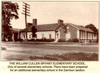
7. The Council should urge upon the Board of Education a careful study of the Teaneck Plan and the records of the Planning Board and the formulation of a harmonized and supplementary twenty-year plan for supplying new school buildings and sites for same.
8. Consideration should be given to the storage of the Township’s trucks and street equipment in a more convenient and central location than that now used.
9. The Council and the Planning Board should collaborate in an endeavor to discourage land subdivision having as its main purpose the mere sale of lots without improvements, while encouraging subdivision by responsible developers who undertake to construct attractive buildings, build streets, and make other improvements.
10. The municipal government should urge upon the West Shore Railroad Company, when times are more propitious, the replacement of the West Englewood railroad station with a more modern and attractive building; the ultimate extension and improvement of parking facilities around the stations; and the southerly extension of the platform on the east side of the Teaneck station to provide direct pedestrian connection with Manor Court.
 11. The authorities should do their utmost to minimize the number of poles which shall be erected hereafter in the public streets, as well as to procure a substantial reduction in the number of such poles now existing, by endeavoring to get the several utility companies to combine in the use of common pole lines. The Township should require that no more wooden poles shall be erected in the future; and also endeavor to procure the collaboration of the several utility companies in beginning the construction of a system of underground conduits which will eventually result in the removal of poles and wires at least from the main business districts.
12. Each year the municipal government should adopt a program of street paving and improvement, including sidewalk improvement, which shall give preference to the major thoroughfares as shown on the Master Plan; and each year the bus routes should be revised and re-allotted in harmony with the completion of thoroughfares and their improvement. No permanent street paving should be done until sewer, gas, and water mains have been placed.
13. The municipal government should also actively support the federal, State, and County governments, and any organized regional group, in such actions as may be taken for the improvement of the Hackensack River and Overpeck Creek and the creation of parks, parkways, major highways, regional or community sewer systems, and other improvements which will affect Teaneck.
14. The municipal authorities should strictly enforce all laws and ordinances respecting street and sidewalk encroachments and obstructions, the littering of streets and sidewalks, the laying and maintenance of sidewalks, and the planting of street trees.
15. When the bridges shown on the Master Plan are constructed all should have roadways not less than 36 feet wide and one sidewalk not less than six feet wide.
16. Traffic guide signs, readily visible at night, for the guidance of visiting motorists should be placed at all important thoroughfare intersections and at other points where confusion is likely to occur.
17. The Planning Board, in passing on and approving future subdivision plats, wherever it may be deemed necessary should require as a condition of approval that where the larger tracts are subdivided appropriate provision shall be made therein for reasonable areas to be set aside for local park and recreational purposes.
Realizing that any project of the magnitude of the Teaneck Plan cannot be carried out unless its various parts are completed in accordance with some schedule, the Board has prepared a tentative and suggestive program covering the more important phases. This program has been arranged in five-year periods to allow of a certain amount of elasticity.
The Board is cognizant of the still-enduring world-wide economic depression and of the impossibility of predicting accurately its termination. Neither can it say accurately how rapidly Teaneck will grow and be able to execute the Plan. The program is offered, therefore, not as a fixed schedule but as a flexible guide subject to revision from time to time as conditions change and needs arise. It is the intention of the Board to review the Plan and what has been accomplished thereunder annually and to submit appropriate recommendations to the Township Council concerning revision.
FIRST PERIOD
The Board has already recommended, in Chapter 3 of this report, certain steps which may be taken at once by the municipal government and these should be included as a part of the work to be accomplished during the first period. There are certain other parts of the Plan which should also be completed in this period.
They are as follows:
1. The Council, immediately upon the adoption of the Official Map by ordinance, should notify the County Clerk of the adoption of a revised Official Map by the Township of Teaneck; such notification to be accompanied by a certified copy of the ordinance.
2. The municipal government should urge upon all affected land owners the gift and dedication to the Township of as much of the lands as can be thus obtained which are shown upon the Official Map as required for street, park, or playground purposes.
3. The municipal government should endeavor to promote action by the County and State with respect to the development for park purposes of those areas within the Township now owned by the County and State as shown on the Official Map and Master Plan.
 4. The County government should be urged to take the necessary steps immediately for the widening and improvement of Teaneck Road so that by the end of five years there will have been completed a uniformly paved roadway at least thirty-six feet wide.
5. The Township to acquire the site (S-16) immediately adjacent to the Town Hall site.
6. The Township to enlarge the present Town Hall and Library.
7. The Township to construct suitable headquarters for the accommodation of the police and fire departments at the Civic Center, selling the present fire headquarters property.
8. The Township to acquire site S-17 and thereon construct a municipal swimming pool and bath houses and develop adequate vehicle parking places. A loan for this purpose might be procured under the terms of the National Recovery Act and might be made self-liquidating through the imposition of reasonable fees.
9. In case the Township may not have received gift deeds thereto, the municipal government should take the necessary steps for the purchase of all of the areas set aside on the Official Map for development as municipal parks, playgrounds, park strips, parking places, and other public open spaces.
10. The municipal government should acquire title to the property (S-28) on South John Street now occupied by the No. 2 pump station.
SECOND PERIOD
1. The municipal government should have plans prepared by a landscape architect for the development of all municipal parks, playgrounds, etc., shown on the Official Map.
2. The Township should make suitable appropriations for the park board to develop a park and playground on site S-14; a park and playground on site S-12; a park and playground on site S-22; and a park and playground on site S-20. Development of the athletic field, park, and playground on site S-6 should also be begun.
3. The Township should complete the new public library in park site S-23.
4. The Township should construct the new bridge over the West Shore Railroad connecting Grayson Place and Sagamore Avenue, and take such steps as may be necessary to complete the new major thoroughfare extending from River Road to Glenwood Avenue, including Sagamore Avenue, Grayson Place, and Midwood Road, as shown on the Official Map.
5. The municipal government should take the necessary steps for the widening of certain parts of Queen Anne Road, Irving Street, and, Tryon Avenue, thus completing a major thoroughfare extending from the Bogota line to the Englewood line, as shown on the Official Map.
6. The municipal government should urge upon the County the improvement of Cedar Lane from Teaneck Road to the Englewood line, with a roadway of at least forty feet and preferably sixty feet.
THIRD PERIOD
 1. The municipal government to construct three new bridges over the West Shore Railroad: connecting Vandelinda Avenue and Kipp Street, connecting the east and west parts of Forest Avenue, and connecting Tryon Avenue and Winthrop Road; also taking such action as may be necessary for the completion of the three new through thoroughfares, as shown on the Official Map, of which these bridges are the connecting links. At the same time the Board of Freeholders should be urged to construct a bridge over the Hackensack River at the west end of Kipp Street extended.
2. The municipal government should provide funds and authorization whereby the park board may substantially complete the development of the park and playground system as shown on the Official Map.
3. The municipal government should construct an incinerator plant for the destruction of garbage and combustible refuse on a site within the disposal plant area lying east of Glenwood Avenue and south of Cedar Lane, as shown on the Master Plan.
FOURTH PERIOD
1. The municipal government should take such action as may be necessary to complete the major thoroughfare system as shown on the Official Map; and should complete the development of any incomplete municipal parks and playgrounds.
2. In case by this time any of the Township’s disposal plants shall have been abandoned, the development of those areas into municipal parks should be begun.
No general can carry out a campaign, no matter how carefully planned, unless he has at his disposal the necessary sinews of war. The most brilliant military strategy is useless unless there are men and guns available to carry it out. So it is with the Teaneck Plan. The “sinews of war” in this case are the finances required to put into actual effect the physical developments which are proposed. The Planning Board has therefore given this side of the picture its careful attention and offers a mode of procedure which it believes well adapted to all prevailing and anticipated conditions.
Before going into the details of the suggestion it might be well to point out that the Plan as it stands is a carefully thought out, educated prediction as to what will take place in Teaneck within the next twenty years. It is relatively accurate for the first five years, but is at all times subject to revision to meet changed physical and financial conditions. If the Plan could be executed in its entirety today or if it were possible to see into the future, the entire cost could be estimated within about twenty per cent. Both of these are obviously impossible, however, and the Board therefore presents its conclusions on this point also. The figure is an important one and it is felt that it is better to assume than to do nothing about it.
Another factor to be considered is the vital importance of giving the Plan an immediate start so that future administrations need only carry on along lines already laid down. A program such as that which is suggested will carry on by its own momentum and there should be no occasion for wide deviations therefrom, no matter what circumstances may arise. The urgency of an immediate beginning by the present Township Council is probably more important than the actual program finally decided upon.
 One of the major considerations of the financial program is the spreading of the cost over a period of years, and how and to what extent purchases of property can best be made. Present conditions restrict us to purchases where owners will accept bonds. The question of the term of these bonds and the extent to which properties should be acquired each year are therefore important questions also. On the other hand, some purchases will require cash and it must be decided whether any part should be raised by budget appropriation or by the issuance and sale of bonds only.
In the absence of any other financial plan the Board is therefore recommending to the Council the issuance of $25,000 worth of ten-year bonds for the purchase of the most important piece of property in 1933, which may probably be bought very advantageously in the present real estate market. This action would give the physical plan its real beginning.
The figure of $25,000 was arrived at by taking 2 1/2 per cent of the values of new construction in the Township in 1932. Since the present basis of assessing property for taxing purposes in Teaneck is about one-third of actual value, this is about 7 1/2 per cent of the increase in ratables due to new construction. If this program were continued each year, using the building figures of the previous year, the Plan would then be effectuated almost simultaneously with the attainment of the growth upon which it is based.
The Board’s theory in suggesting this program is that a certain sum may logically be spent for general Township betterment as the population increases. On the other hand, there are certain permanent improvements now existing which new residents will enjoy but for which they will assume no part of the burden of the cost. In no other way than that proposed could these newcomers be taxed for the improvements which they will enjoy in proportion to the load borne by present taxpayers who have a large capital investment in the community at the present time.
To those who point out that the ratio of gross debt to the total ratables is the criterion of those who purchase bonds and that for this reason the gross debt should be cut down rather than increased, the Board wishes to give certain figures. The present gross debt amounts to 25.51 per cent of the assessed valuation. The proposed increase in bonded indebtedness would be 7 1/2 per cent of the increase in ratables due to new construction. It is obvious, therefore, that the small sum suggested annually would not increase the present ratio, since even if bonds were issued in an amount equal to 25 per cent of the new ratables and the existing debt not cut down, the present ratio would merely remain stationary.
It should be noted, also, that investment in well planned capital improvements would eventually be reflected in the Township’s credit standing in any event. The existence of such improvements would almost certainly have a favorable effect in the minds of those who might purchase bonds in the future.
It is possible that other factors than the value of new buildings should be considered in this connection. Increased ratables, population, local improvements, or any combination of these may have an important bearing on the financial program finally adopted. Another plan might be to establish a fixed amount each year, plus a percentage of one or more of the above factors.
As a practical example of how this might be accomplished the reader is referred to the schedule included herein of properties to be acquired for other than street purposes. The present value of all of the sites, enumerated is about $400,000, but it is estimated that in 1952 the same property may be worth $1,000,000. This means an average value if purchased in regular amounts during the whole period of approximately $700,000.
This might be met by beginning in 1933 with the same sum as that suggested in the Board’s first program, namely $25,000. This might then be increased 10 per cent annually until the sum of $50,000 was reached in 1952. Such a program would mean an average annual expenditure of $37,500, or a total expenditure of $750,000 over the twenty-year period.
Still a third method would be appropriations based upon population increase and, therefore, upon the increase in wealth. This would produce results similar to the other plan, but in a somewhat more irregular fashion.
It has also been suggested that certain properties which have been foreclosed for unpaid taxes might be substituted for the park and playground sites recommended in the Plan. The Board, if given complete data on these properties, might amend the Plan along those lines. This could be done, however, only if the new sites were considered economical from every standpoint.
So far only those parts of the Plan requiring the purchase of land have been considered. Expenditures for other important items will be necessary and these have been outlined below, together with suggestions for financing them:
1. Bridges or overpasses. Some of these can be considered aside from any Planning Board program and more in the nature of County or State road improvements.
2. Improvement of parks, playgrounds, and lands obtained for rights-of-way for through streets, etc. These could be taken up for independent action by the Township Council as desirable, possibly after a referendum vote on the expense or, if not too extensive, by budget appropriations under “Parks and Playgrounds.”
 3. Loss of ratables due to purchases of property by the Township. This will be at the most only from one-third to one-half of the purchase price. Furthermore, it is entirely possible that the capital investments will have a great indirect effect on ratables throughout the community and largely offset losses incurred by taking out of ratables the properties purchased by the Township.
4. Future school sites and facilities. The Board of Education evidently desires to act independently on this matter and it has therefore been left out of the Planning Board’s considerations.
These are the suggestions of the Board as to the best way in which to finance the Plan and they are the result of careful study and consideration. It is entirely possible, of course, that the Township Council may choose to modify them or to replace them by some other program better suited to the circumstances which may arise, but whatever program is finally decided upon, it is the primary contention of the Board that a portion of the new wealth which will come to the Township should be dedicated to the fulfillment of the Teaneck Plan.
The Existing Conditions Map shows as many of the conditions existing in the Township as can thus be recorded. Not only does it show the natural physical conditions, including the topography, but also street conditions, lot lines, private and public properties, and all buildings and the purpose for which they are used.This map strikingly shows a great disparity between the extent of land subdivision and the construction and improvement of public streets, as well as a deficiency in recreational areas. A study of the map also discloses the fact that Teaneck has not a clearly defined general business district — no “Main Street” — as is the case in most comparable communities. On the other hand, it has five distinct business districts, each more or less local in character, that on Cedar Lane being the most recently developed. This distribution of business establishments, rather than a central concentration, is a convenient one to the neighborhoods they serve, but there is reason to believe that a “Main Street” is developing along Cedar Lane.
It is expected that this Existing Conditions Map shall be retained in the Township Engineer’s office and a copy revised each year to show what changes have been made in the physical conditions of the township as a result of carrying out the Plan or otherwise. By following this procedure an up-to-date map of this kind can be made helpful to various of the Township’s governmental departments.
The revised Official Map, now presented for adoption through the enactment of a suitable ordinance, is based upon a newly prepared base map of the Township drawn to a scale of 300 feet to the inch and shows the street pattern as the Planning Board believes it should be eventually. In addition to showing the actually existing public streets, it shows those “paper” streets which should be taken over formally as public streets; existing streets which should be extended; streets which should be widened, straightened, or otherwise changed in their alignment; certain streets which should be abandoned; and various new streets which should be established and eventually constructed.
The map shows also the locations of three proposed bridges over the West Shore Railroad and the locations of many new public parks and playgrounds.
The proposed improvements and additions are so clearly indicated on the Official Map by special designations and symbols and their desirability is so self-evident that a detailed description would be superfluous. The more important of the proposals are described and commented upon in the section of this report dealing with the Master Plan.
In considering the Official Map it must be understood that the municipality will not bear the financial burden of opening and constructing all of the new streets and of making all the street improvements shown on this map; nor is it to be expected that the municipal authorities will immediately undertake the great majority of the improvements indicated. (See Chapter 4.) On the contrary, one of the fundamental purposes of the map is to serve as the basic means whereby the governing body of the Township may legally and definitely establish not only the lines of existing streets and public open spaces, but the lines which should be followed when additional streets or public open spaces are laid down on maps or otherwise established when parcels of land are subdivided.
In order that the Planning Board may be enabled in the future to properly control land subdivision and also in order that the subdivider may have some official pattern to guide him in platting his proposed streets, it is essential that the municipality shall establish some map which shows at least all proposed thoroughfares and major streets as the Official Map. Therefore, this map is presented principally as a basic street pattern to be followed by all future subdividers. It will be the duty of the Planning Board to see that in the future all land subdividers shall harmonize their subdivision plats therewith.
In establishing the new streets shown on this map the Planning Board has confined itself largely to laying down the lines of what it considers to be logical and essential extensions of existing streets. In many cases these extensions take the form of supplying missing links which will convert merely local streets into through streets. New streets are not shown in various areas which have not yet been subdivided, for the reason that the Planning Board considers it best to permit the individual subdivider to lay out future minor streets. The Board will see that such streets accord with the established pattern.
A careful study of the Official Map as revised, of the Master Plan, and of the Existing Conditions Map makes it immediately apparent that the majority of the street extensions and new streets proposed must result eventually from land subdivision without expense to the Township for land takings. In various other cases the provision of new or extended streets not resulting from land subdivision will open up and so enhance the values of abutting properties that the owners should be glad to freely dedicate the lands to the Township. It would be necessary in but a few cases to purchase land for the proposed improvements other than parks.
Neither would it be necessary, if early action is taken, to acquire or disturb any existing building in constructing any recommended street shown on the Official Map, with the exception of a few inexpensive buildings on Teaneck Road. This is true also insofar as the areas set aside for park and playground purposes are concerned.
 Another of the main purposes in adopting an Official Map which shows the areas set aside for future streets, parks, and playgrounds is to protect the municipality against the erection of buildings within those areas during the interval between the adoption of the Map and the acquisition of the land, except under such conditions as may be authorized by the Board of Adjustment on application by the owner. In this connection it might be explained that the State Planning Law provides that when street lines are established on an adopted official map no building may be erected between such lines unless application is made to the Board of Adjustment and that Board either recommends to the governing body the cancellation of the street lines on the official map, or grants the applicant permission to construct a building of moderate cost to exist for a limited period.
Precedent to the formulation of this map, investigation was made of any prospective plans of State or County agencies and of adjoining municipalities likely to affect Teaneck. The proposals of the Regional Plan of New York and Environs were also considered.
Although Teaneck’s present street system has many shortcomings and defects, the system when completed in accordance with the Official Map will be one of which Teaneck need not be ashamed. Teaneck will then have a good system of minor streets and an excellent system of major thoroughfares, many of which will extend entirely through the town.